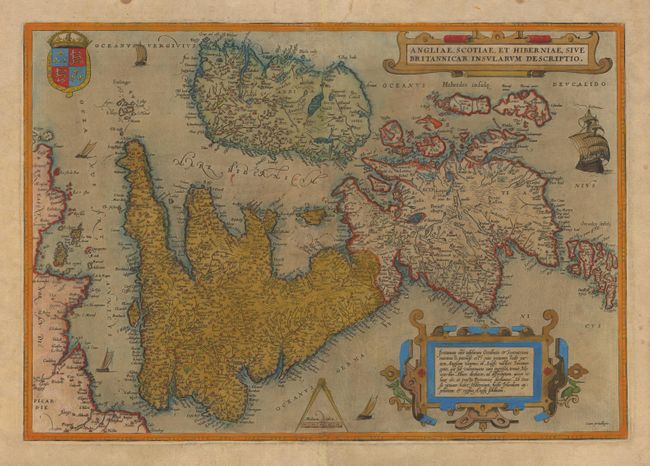
Subject: Britain
Period: 1570-73 (published)
Publication: Theatrum Orbis Terrarum
Color: Hand Color
Size:
19.6 x 13.5 inches
49.8 x 34.3 cm
An early and fine map of the British Isles by one of the greatest names in cartography. Flemish influence, and/or misreading of the text, is evident in the rendering of some of the names, e.g. Ormyskyrk for Ormskirk and Dantre for Daventry, and the omission of the relatively important Peterborough. The two decorative cartouches are surrounded by ornate strapwork. The map is further embellished with a royal coat of arms, a compass and scale and five ships under sail. Overall, a fine example of Ortelius' earliest map of the British Isles, in a wonderful early edition. This being the 1st state; 2nd Latin edition with Latin text on verso. The map is based on the large map by Gerard Mercator, to whom due acknowledgement appeared among the many prominent cartographers listed by Ortelius in the preamble to his atlas, the "Theatrum Orbis Terrarum".
References: Koeman 6, Ort. 9; Van den Broecke 16; Shirley, Early Printed Maps of the British Isles, 86 and 104,
Condition: B
On a full sheet of thick, hand laid paper that is evenly age toned. Old color is oxidized, but still fairly bright, that combined with the toned paper gives a very 'old world' appearance. Paper is mostly sound, with some weakness along the centerfold.