Catalog Archive
Auction 97, Lot 129

"Map of the Canadian Yukon and Northern Territory of British Columbia", Anon.

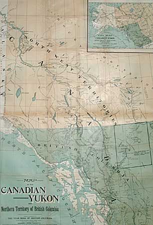
Subject: Canada and Alaska

Period: 1897 (published)

Publication: The Year Book of British Columbia

Color: Printed Color

Size:
26.5 x 38.5 inches
67.3 x 97.8 cm
Download High Resolution Image
(or just click on image to launch the Zoom viewer)

Very large, poster style, map issued by the Province Publishing Company. It shows the mining areas of the Klondike and much else of interest. Large inset "Key Map of the Canadian Yukon and Northern Territory of British Columbia and Routes Thereto" showing all of Alaska and the steamship route to the mouth of the Yukon River. Verso contains numerous photographs of the area with text concerning the regulations governing placer mining (now partially obscured by the repairs). An interesting ephemeral map of the Yukon Gold Rush.

References:

Condition: B

Issued folded and now backed with tissue. Several fold separations repaired with some loss patched at fold intersections.

Estimate: $170 - $200

Sold for: $120

Closed on 12/5/2001

Archived