Subject: Atlas
Period: 1863 (published)
Publication:
Color: Hand Color
Size:
15 x 18.5 inches
38.1 x 47 cm
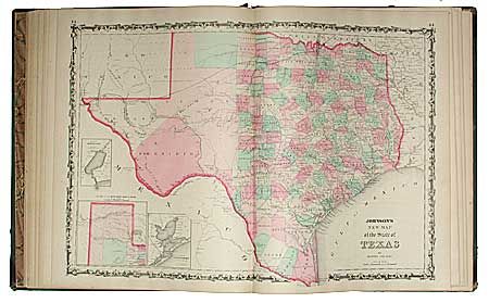
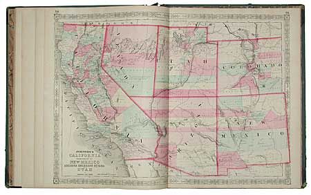
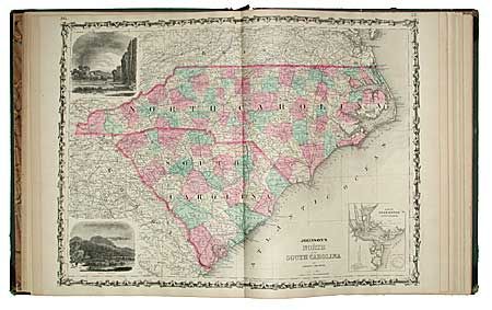
Complete atlas with about 65 steel engraved and hand colored maps. Beautifully rendered maps with fine color and all are bright, crisp impressions. This is the last year with steel engraved plates and the edition in which many of the maps feature vignettes. With the additional, double- page Civil War maps "Vicinity of Richmond" and the "New Military Map of the United States". The Southwest map is the first Johnson issue showing the newly created Arizona Territory. It also shows the Pony Express route.
References:
Condition: A
Maps are fine with little or no foxing. Quarter green leather on spine. Cover is rubbed and detached at the front. Contents and are mostly tight and nicely aligned. A very nice example of this atlas that needs a little binding care.