Subject: World
Period: 1700 (circa)
Publication:
Color: Hand Color
Size:
18.5 x 15.5 inches
47 x 39.4 cm
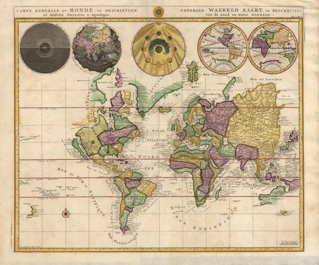
Interesting world map from a Dutch Bible. The map is drawn on Mercator's projection with CALIFORNIA AS AN ISLAND and the Detroit d'Anian connected by dotted lines through the NORTHWEST PASSAGE to Buttons Bay located to the west of Hudson Bay. In the Pacific is a small coastline of New Zealand. The northeast coast of Asia is severely truncated. Australia's northern coast is shown connected to New Guinea, along with a part of Van Diemen's Land. Across the top of the map are five spheres depicting Day and Night, the Flood, the phases of the moon, and the West and East Hemispheres.
References: Shirley #622.
Condition: A
Light soil in margins and one tiny hole in China, else fine.