Catalog Archive
Auction 96, Lot 152

"Map of the Region Occupied by the Ancient Ruins in Southern Colorado, Utah and Northern New Mexico and Arizona Also Showing the Locations of Most of the Modern Pueblos", Wheeler, George (Lt)

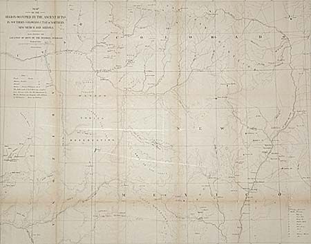
Subject: Southwestern United States

Period: 1876 (circa)

Publication: 10th Annual Report of the Bureau of American Ethnology

Color: Black & White

Size:
24.5 x 19.1 inches
62.2 x 48.5 cm
Download High Resolution Image
(or just click on image to launch the Zoom viewer)

Prepared for the report by W.H. Holmes entitled "Report on the Ancient Ruins...Examined during summers of 1875 & 76". This map was the result of a thorough investigation of the area in the early days of archeological research and would form the starting point for subsequent and more detailed examinations of specific ruins in the years to come. Extends from the New Mexican pueblos of Taos, Santa Clara, San Ildefonso, and Laguna west to show the Hopi Mesas. Locates numerous forts. Good topographical and watershed detail.

References:

Condition: B

Backed with Japanese tissue. Toned along folds.

Estimate: $75 - $100

Sold for: $70

Closed on 9/12/2001

Archived