Catalog Archive
Auction 96, Lot 146

"Map of the Route Passed over by an Expedition into the Indian Country in 1832 to the Source of the Mississippi", Allen, James (Lt.)

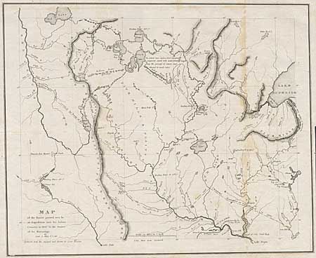
Subject: Central United States

Period: 1834 (published)

Publication: HR Doc 323, 23rd Congress, 1st session

Color: Black & White

Size:
19 x 15.5 inches
48.3 x 39.4 cm
Download High Resolution Image
(or just click on image to launch the Zoom viewer)

Scarce and important map issued to accompany the report by Schoolcraft and Allen. The map covers the region of present -day Minnesota from the western tip of Lake Superior to the Red River. It depicts Ft. Snelling, scores of Sioux villages, American Fur Company trading posts, and many other fascinating details. It locates the source of the Mississippi River at 47? 10' N and 95? 54' W. Henry Schoolcraft led the expedition into the upper Mississippi valley to attempt a reconciliation between the Sioux and Chippewa, and to vaccinate the Chippewa Indians. In the process he found time to search for the headwaters of the Mississippi, which led him to its source in Lake Itaska.

References:

Condition: B

Folding as issued with scattered foxing, stronger along one fold.

Estimate: $300 - $350

Sold for: $300

Closed on 9/12/2001

Archived