Catalog Archive
Auction 96, Lot 143

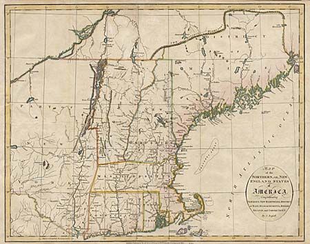
"Map of the Northern, or New England States of America, Comprehending Vermont, New Hampshire, District of Main, Massachusetts, Rhode-Island, and Connecticut", Russell, John C.

Subject: New England

Period: 1795 (dated)

Publication:

Color: Hand Color

Size:
18.1 x 14.4 inches
46 x 36.6 cm
Download High Resolution Image
(or just click on image to launch the Zoom viewer)

Handsome copper engraved map of New England prior to the final settlement of the boundary between the United States and Canada. The District of Maine is bounded on the north by The Dividing Highlands and on the east by the St. Croix River. Provides a nice view of early settlements.

References: McCorkle #795.9.

Condition: B

Trimmed to neatline with margin extended at left. Tissue repairs of binding tear and folds reinforced. Couple of small tears in margins.

Estimate: $300 - $350

Sold for: $400

Closed on 9/12/2001

Archived