Subject: Colonial North America and West Indies
Period: 1746 (circa)
Publication:
Color: Hand Color
Size:
22.5 x 18.7 inches
57.2 x 47.5 cm
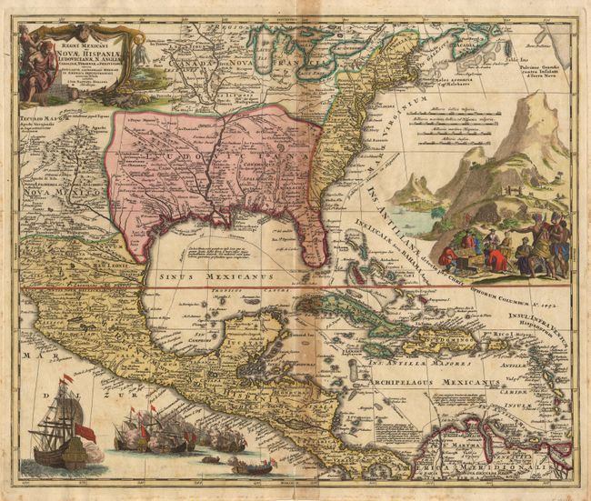
Magnificent, decorative map covering from the Great Lakes and Nova Scotia through Central America and Venezuela, and from present day Arizona to the eastern seaboard. The British colonies are shown confined east of the Appalachians. The map itself is filled with settlement place names, Indian tribes and villages. The sheet is richly embellished with a fine title cartouche depicting two native figures and symbols of America's natural resources. In the Atlantic is a large and fully colored engraved scene of extensive gold mining operations with Indians bringing their treasures to fill the European's treasure chest. Off the Pacific coast of Mexico is yet another opulent engraving of a raging sea battle between many ships, also fully colored.
References: Van Ermen p.42, Cumming (Southeast) #137, Martin & Martin plt.17.
Condition: B
A crisp, bright impression on thick hand-laid paper with watermark. Acid burn along centerfold and a little foxing in margins. Clean split at lower centerfold, just touching neatline.