Subject: Colonial New England
Period: 1653-58 (published)
Publication: Nieuwen Atlas
Color: Hand Color
Size:
20 x 15.2 inches
50.8 x 38.6 cm
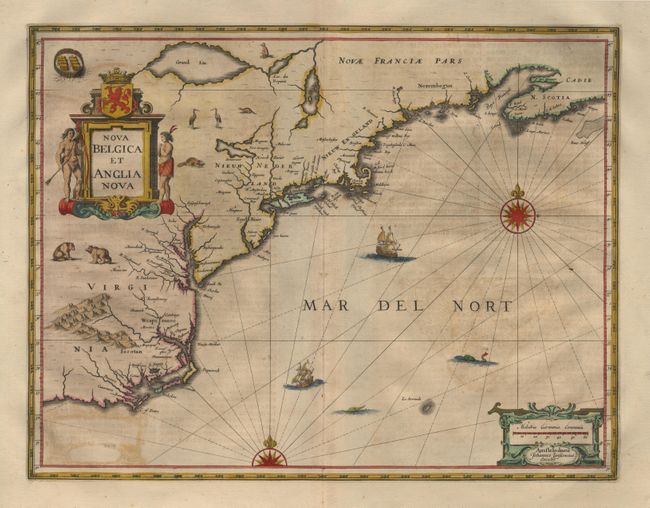
Jansson's influential map of the eastern coast of North America first issued in 1636. It is derived from the less well know map of Johannes de Laet of 1630. The map includes part of the Great Lakes labeled Grand Lac and Lac des Yroquois, an unnamed Lake Champlain, and a fictitious lake at the headwaters of the Delaware River. This is the second state with the alternate title, giving greater prominence to the Dutch colonies, and with the addition of wildlife throughout the interior. German text on verso. Lovely original outline color with fully colored cartouche and adornments, which include ships, sea monsters and compass roses.
References: Burden #247; McKorkle #636.2.
Condition: B
Tiny hole in bottom margin, well removed from the image. Some light offsetting, otherwise very good.