Subject: Gulf of Mexico and Caribbean
Period: 1650-80 (circa)
Publication:
Color: Hand Color
Size:
22.2 x 18.2 inches
56.4 x 46.2 cm
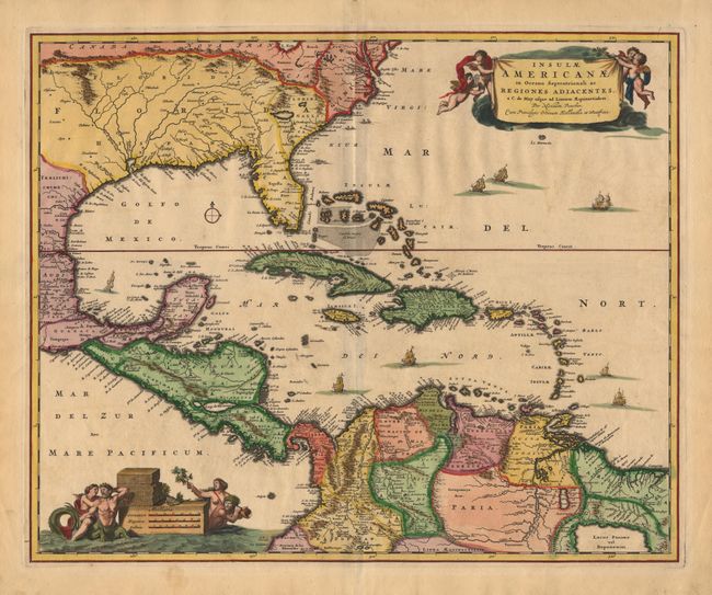
Stunning map of the Caribbean, which includes the southeastern U.S., from the Chesapeake through the Gulf of Mexico, with Central America and the northern part of South America. Two lovely cartouches with cherubs and mermaids decorate opposite corners. Eight ships sail the seas and three native canoes are depicted off the coast of North America. A number of interesting cartographic myths appear on the map. These include two large nonexistent lakes in the region of western Georgia, a non-existent mountain range extending from the Piedmonts right across the continent, and the archetypal cartographic myth, 'Manoa o' El Dorado', located on 'Lacus Parime' in Guyana. Crisply engraved with numerous place names and topographical features.
References: Portinaro & Knirsch #82.
Condition: A
Slight bit of unobtrusive soil and a tiny worm hole in border, still overall very good. Original color appears to have been recently augmented.