Subject: Western Hemisphere
Period: 1730 (circa)
Publication:
Color: Hand Color
Size:
22.5 x 19.2 inches
57.2 x 48.8 cm
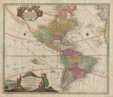
A revision of the elder Homann's 1710 map of the Americas. After his death in 1724, his son (Johann Christoph Homann) re-engraved the plate to correct the western coastline of North America. California is no longer shown as an island, although the remnants of the interior sea can be seen near the 'Pais de Moozemleck'. Good detail near the Great Lakes, which were then actively being explored by the French fur traders and Hudson's Bay Company. Two large pictorial cartouches and two small compass roses.
References:
Condition: B
Original color on map with later fully colored cartouches. Faint damp stain lower left and a small water stain on the equator. Crisp impression and attractive color.