Subject: Central Europe
Period: 1588 (published)
Publication: Theatrum Orbis Terrarum
Color: Hand Color
Size:
19.7 x 14.3 inches
50 x 36.3 cm
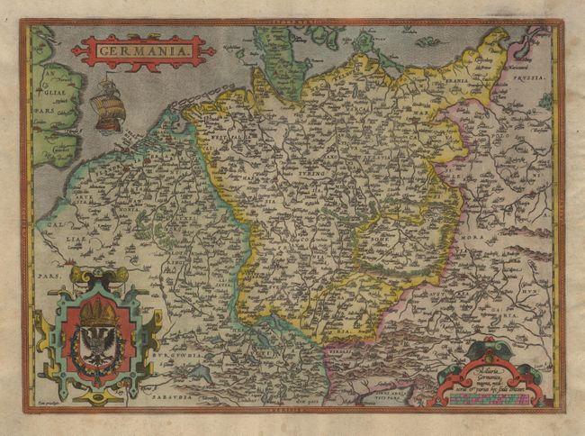
Elegant map of the German Empire, which at the time included the Netherlands and Belgium, stretching from Calais to the Wista River in present day Poland, and south to the Adriatic Sea. Ortelius based this beautiful map on Christiaan Sgrothen's map of 1565. The title is enclosed is a strapwork cartouche, below which sails a large ship, and two large cartouches incorporate the royal coat of arms and scale of miles. Spanish text on verso.
References: Van den Broecke #56.
Condition: A
Minor foxing in margins and a few very faint spots, still overall a very good example in beautiful old color.