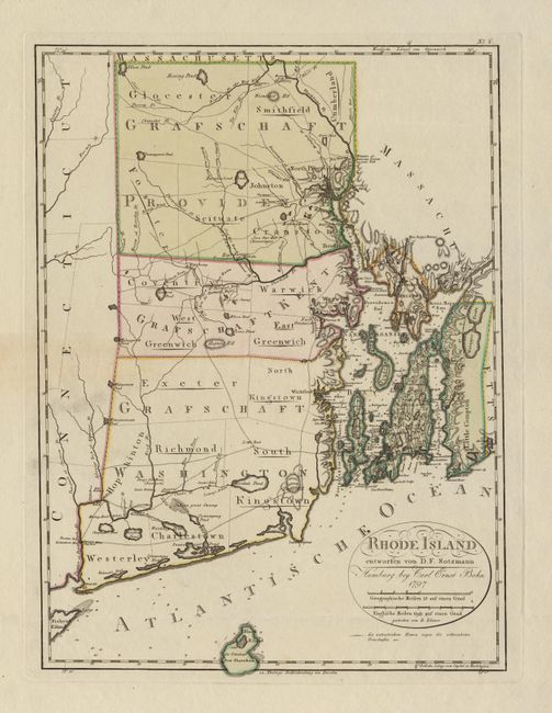
Subject: Rhode Island
Period: 1797 (dated)
Publication: Atlas von Nordamerika
Color: Hand Color
Size:
17.2 x 25.2 inches
43.7 x 64 cm
This was one of the ten maps completed by Sotzman for Christoph Ebeling's planned atlas of the United States, which was published in parts by Carl Ernst Bohn. Five counties are shown with nearly all the population centered around Narraganset Bay. The balance of the map provides detail of the roads, trails, meeting houses, swamps and ponds. Sotzman's maps were highly regarded at the time due to the level of detail. However, the project was interrupted by the Napoleonic Wars and the individual maps are now very scarce. Ristow notes that these maps "are among the rarest of cartographic Americana for the closing decade of the eighteenth century".
References: Ristow p. 169-178.
Condition: A+
Clean, crisp image and original color. Very wide margins with a minor bit of soil at edges.