Catalog Archive
Auction 94, Lot 86

"Nouvelle Carte Illustree de l'Amerique du Nord indiquant les grandes divisions physiques, la distribution geographique des vegetaux et des mineraux", Vuillemin, Alexander A.

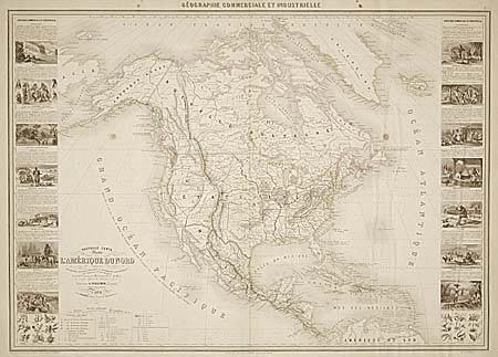
Subject: North America

Period: 1860 (dated)

Publication:

Color: Hand Color

Size:
33.2 x 23.5 inches
84.3 x 59.7 cm
Download High Resolution Image
(or just click on image to launch the Zoom viewer)

Very large, impressive thematic map of the continent illustrating the physical and geographical divisions, and the plant and mineral distributions. The map is flanked by vignettes featuring scenery and the customs and occupations of the indigenous people. There are great scenes of dog sledding, turtle fishing, sugar harvesting, etc. Each vignette represents a different country or region. The map shows Russian America, the United States with early western territories, Mexico and Central America, and all of the West Indies. It includes fine topographical detail as well as showing the roads, canals, railroads, forts, mines, and Indian tribes.

References:

Condition: B

There are a couple of small spots in the map, but it is overall very clean and attractive.

Estimate: $600 - $700

Sold for: $300

Closed on 3/7/2001

Archived