Subject: Western Hemisphere
Period: 1713-29 (published)
Publication:
Color: Hand Color
Size:
26 x 18.5 inches
66 x 47 cm
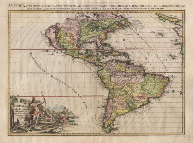
Large impressive map of the Americas with the most notable feature being the ISLAND OF CALIFORNIA with its heavily indented Northern coastline. The British colonies are confined to the Eastern seaboard by "Les Cinq Nationals Iroquoises" while the French possessions extend to the Mississippi River. The Spanish possession of Florida includes the Carolinas, Florida and the Gulf of Mexico coastal regions. Nova Mexicans and Nova Granada take in nearly all of the west coast. In South America, the Amazon is the most prominent feature with the Orinoco being confused with the River Negro. The entire map is filled with detail and notations. Superb large pictorial title cartouche features a legendary Amazon with her bow held high and a cannibalistic feast in the background. The map was drawn by J. Goeree and engraved by J. Baptist, with imprint in cartouche.
References: McLaughlin #184; Tooley (America) #71, p.129; Wheat #95.
Condition: A
Map is backed with Japanese tissue with some scattered insect damage expertly filled and some facsimile of lettering. Slight center crease and unevenness of paper tone, still a very good example of this great map.