Subject: North Pole
Period: 1639-49 (published)
Publication: Nouvel Atlas
Color: Hand Color
Size:
19.5 x 17 inches
49.5 x 43.2 cm
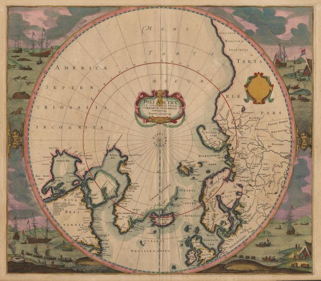
Hondius' important map of the polar region which replaced Mercator's polar map and incorporated much of the knowledge gained by the English in their search for a Northwest Passage to Asia. The cartography is based on Henry Briggs depiction of Hudson Bay. There are several Dutch names in Labrador, many appearing for the first time on this map. The fascinating whaling scenes which surround the map also depict Dutch activity in the region. Strapwork title cartouche and a second blank cartouche. Third state of the plate, and the first to include the whaling scenes. From a French edition with the page number 'B' on verso. $2000 RESERVE
References: Burden #246.
Condition: A
Couple of very faint stains in Greenland, still a very good example with superb contemporary color.