Subject: North Atlantic
Period: 1650 (circa)
Publication:
Color: Hand Color
Size:
22 x 17 inches
55.9 x 43.2 cm
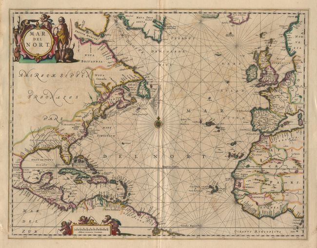
This map was designed for Jansson's important sea atlas, "Atlantis Majoris Quinta Pars, Orbem Maritimum", the first of its kind intended for the general market, and incorporated into his later publications throughout the 1660's. The chart covers the northern Atlantic Ocean with the eastern coast of North America, the West Indies, and the coasts of Europe and North Africa. Cartographically based on the previous maps produced by Hondius and Jansson, with a few notable improvements. The single Great Lake is replaced by a lake full of large islands and a complex system of waterways feeding the St. Lawrence River. There is a significant improvement in the delineation of the coastline between Chesapeake Bay and Long Island and in the north it shows "Groenlandia" separated by "Meta Incognita". The handsome chart is arrayed with rhumb lines radiating from a central compass rose, and the title and distance scale cartouches feature a Native American, several putti and a variety of indigenous animals.
References: Burden #290.
Condition: B
A bit of unobtrusive offsetting and slight abrasion along centerfold, still a nice example with full original color.