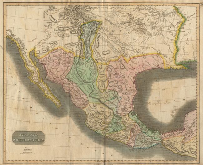
Subject: Mexico
Period: 1814 (dated)
Publication: Thomson's New General Atlas
Color: Hand Color
Size:
24.32 x 20 inches
61.8 x 50.8 cm
Large, attractive and significant map depicting the Spanish possessions in North America. Especially noteworthy is the delineation of the great river systems, particularly the Platte flowing east and south of the Rocky Mtns. According to Wheat, the map originated primarily from the epic Humboldt and Pike maps and to some extent the Pinkerton and Arrowsmith maps published a few years earlier. Texas appears within the province of "St. Louis de Potosi". Names many Indian tribes and villages.
References: Wheat (TMW) #320.
Condition: B
Some age toning and soft creases, as often seen on this large sheet, lower margin a little rough. A very handsome map.