Catalog Archive
Auction 94, Lot 147

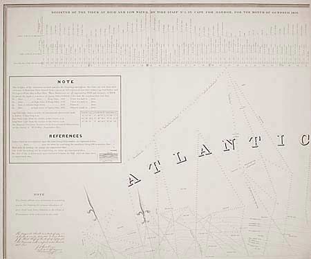
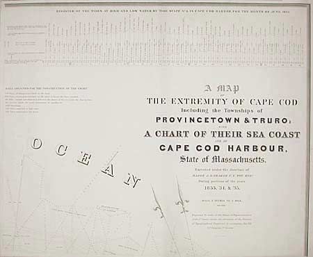
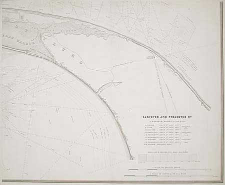
"A Map of the Extremity of Cape Cod including the Townships of Provincetown & Truro: A Chart of their Sea Coast and of Cape Cod Harbor", U.S. Government

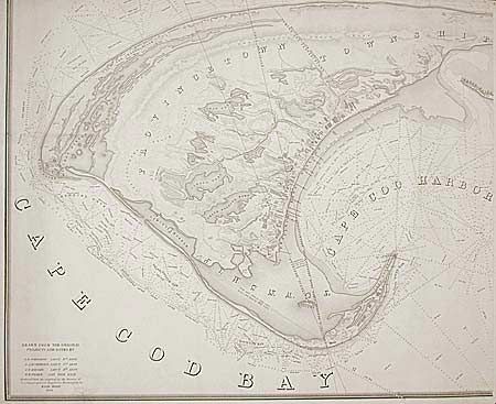
Subject: Massachusetts

Period: 1833-35 (dated)

Publication: J.D. Graham U.S. Top. Engineer

Color: Black & White

Size:
See Description
Download High Resolution Image
(or just click on image to launch the Zoom viewer)

Set of four sheets, each measuring 35.2 x 29". This is an very scarce and extraordinary chart of Cape Cod. Tide Register across the top, showing levels for October 1833 and June 1835. Provincetown is shown in great detail with a town plan showing churches, houses and wharves. There is excellent interior detail with roads, hills and ponds. A separate symbol locates extensive evaporating facilities for making salt. Excellent navigational detail with soundings and lighthouses shown. This is a wonderful early, and visually powerful set of charts. The maps were issued separately but can be joined to form a huge wall map with continuous, boldly engraved, keyboard style borders all around.

References:

Condition: A

Cleaned with a couple of short tears expertly repaired.

Estimate: $1,200 - $1,300

Sold for: $650

Closed on 3/7/2001

Archived