Subject: Western Hemisphere
Period: 1592 (circa)
Publication: Book III Grand Voyages
Color: Black & White
Size:
17.2 x 14 inches
43.7 x 35.6 cm
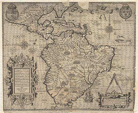
Focusing on the Spanish possession in the Americas, this map covers what is the present-day southern U.S. through South America. It was published to accompany the accounts of the voyages of Johann van Stadden and Jean de Lery. The cartography is drawn from de Bry's own map of Florida and the West Indies after Jacques le Moyne. However, there is no easily discernible source for the South American cartography, with its southern regions shown too broad, but not quite bulging as with the Ortelius version. De Bry's extraordinary engraving skill and artful style are very evident with the large elaborate cartouches, coats of arms, two compass roses, sea monster, Spanish galleon and intricate border.
References:
Condition: C
This example of this rare map has had extensive damage with two areas of loss at top and one in the Paraguay region of South America. There is also loss to the border on three sides. It has been stabilized with some paper added and backed with Japanese tissue. Though the areas of loss are a bit distracting, the exquisite engraving of the balance of the map is very appealing.