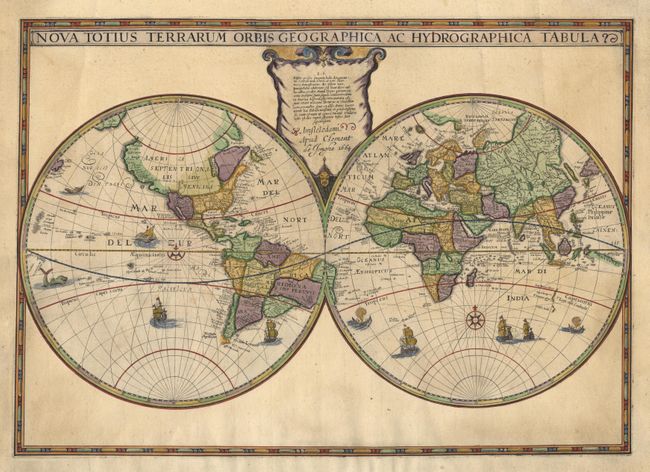
Subject: World
Period: 1664 (dated)
Publication:
Color: Hand Color
Size:
22 x 15.5 inches
55.9 x 39.4 cm
Double hemisphere map first issued by Hondius in c. 1625. It was the first map to show the Dutch discoveries in western Australia taken from the Hessel Gerritsz manuscript map of the Indian Ocean. The North American continent is much narrower than on previous Hondius maps, but South America is still misshapen. The large southern continent shown on his previous map is completely gone. The map is decorated with a number of sailing ships, sea monsters and compass roses. Hondius' map had a long life with six known states; this being from state 3 published by Clement de Jonghe. This example is lacking the surrounding allegorical scenes.
References: Shirley #433.
Condition: A
The map, cartouche and title have been salvaged and inset into surrounding borders of old laid paper with a facsimile border. The workmanship of this restoration is simply amazing, as the paper joints are only visible from the verso. The resulting map, though quite different in appearance, is very attractive.