Catalog Archive
Auction 93, Lot 152

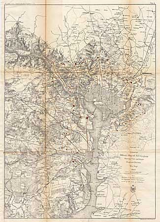
"Extract of Military Map of N.E. Virginia showing Forts and Roads", U.S. War Dept.

Subject: Virginia

Period: 1865 (dated)

Publication: Pub HR ex doc 1, Chief of Engineers, 39th Congress 1st Session

Color: Hand Color

Size:
16.7 x 23.5 inches
42.4 x 59.7 cm
Download High Resolution Image
(or just click on image to launch the Zoom viewer)

Shows District of Columbia and streets grids for Washington and Alexandria. Many of the forts and roads within the District are shown in color. Very detailed including forested areas and farmsteads. An important map for understanding the field of operations in N.E. Virginia during the Civil War. It is the most interesting of the 14 maps included in the report of the Army Chief of Engineers and consequently often suffers abuse, this example being in remarkable condition.

References: Stephenson (CW-1) variant of 685-7.

Condition: A

This example being in remarkable condition. Backed with Japanese tissue with pinholes at centerfolds repaired.

Estimate: $250 - $300

Sold for: $230

Closed on 12/6/2000

Archived