Subject: Canada
Period: 1695 (published)
Publication:
Color: Black & White
Size:
19 x 23.7 inches
48.3 x 60.2 cm
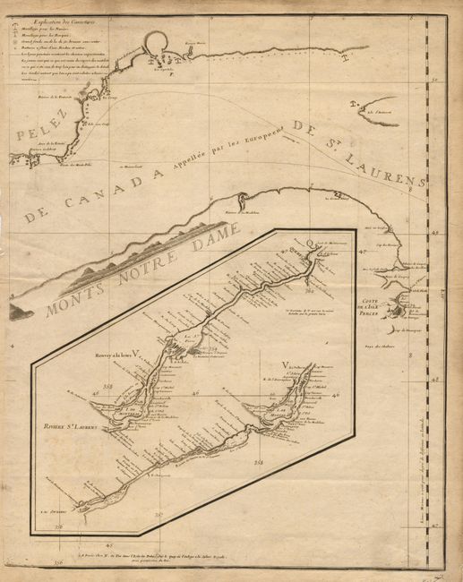
Eastern sheet of the first printed chart of the St. Lawrence River. The chart was drawn by Jean Deshayes during the first hydrographic survey of the river and published by Nicolas de Fer. Covers the mouth of the river in detail from "Point des Monts Peles" to "Coste de l'Isle Percee" with a large inset covering from Quebec to Lake Ontario. The chart is very rare, owing to the fact that they were working navigation charts. There were three states published between 1695 and 1715, this being a first state.
References: Kershaw #618.
Condition: A
Minor toning and marginal tears.