Subject: World
Period: 1784 (dated)
Publication:
Color: Hand Color
Size:
22.4 x 18.7 inches
56.9 x 47.5 cm
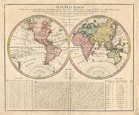
Interesting large double hemisphere map by this famous German family of mapmakers. There is some curious cartography, given the date of the map. The Great Lakes are shown as one huge body of water and California is strangely shaped with the Baja nearly appearing as an island. Australia, includes several placenames on the eastern coast, which resulted from Cook's discoveries in 1770. However, Van Diemens Lands is still shown connected to the mainland. The tracks of several late 18th century expeditions are shown. Original color, with color key. German text panel below the hemispheres.
References:
Condition: A
Original color, with color key. Minor surface soil, mostly in margins, and a couple of soft folds along centerfold..