Catalog Archive
Auction 92, Lot 206

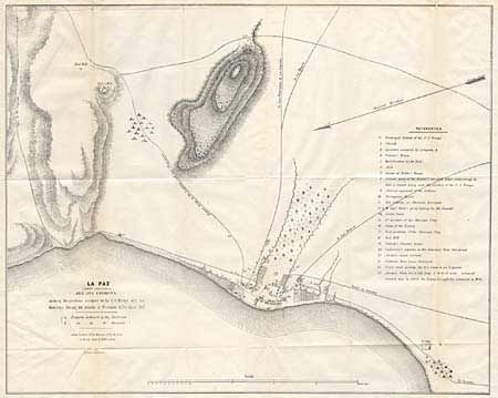
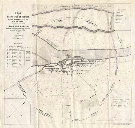
"La Paz (Lower California) and its Environs [together with] Plan of Santa-Cruz de Rosales…", U.S. Government

Subject: Mexico

Period: 1847-48 (dated)

Publication:

Color: Black & White

Size:
See Description
Download High Resolution Image
(or just click on image to launch the Zoom viewer)

Pair of lithographed Mexican-American war maps. First (20.5 x 16.2") depicts the positions occupied by the U.S. Troops and the Mexicans during the attacks in November & December 1847. This is an early chart of what is now a major Baja resort destination. Second (12.7x 12") depicts the siege with troop placements surrounding the town. Folding as issued.

References:

Condition: A

Estimate: $140 - $160

Sold for: $120

Closed on 9/13/2000

Archived