Catalog Archive
Auction 91, Lot 95

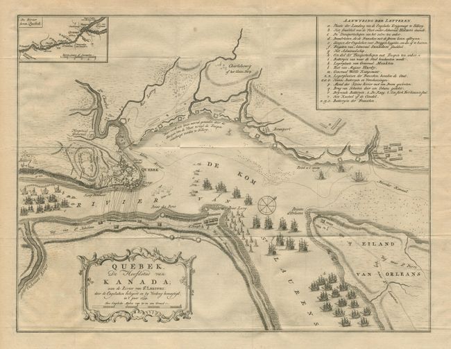
"Quebek, De Hoofdstad van Kanada aan de Rivier van S.' Laurens: door de Engelsen belegerd en by verdrag bemagtigd in 't jaar 1759.",

Subject: Canada

Period: 1769 (published)

Publication: Nieuwe en beknopte Hand-Atlas

Color: Black & White

Size:
16.8 x 12.9 inches
42.7 x 32.8 cm
Download High Resolution Image
(or just click on image to launch the Zoom viewer)

A handsome copper engraved map, closely copied from a similar plan by Thomas Jeffreys. The map depicts the English seige and attack on Quebec, which resulted in the city's capture and ultimately the end of the French and Indian War. Small inset of "De Rivier boven Quebek". Key in upper right to the map identifies the fleets, batteries, fortifications etc. Decorative title cartouche. Very bright and clean. Ref: Kershaw #1018.

References:

Condition: A+

Estimate: $300 - $375

Sold for: $240

Closed on 6/14/2000

Archived