Catalog Archive
Auction 91, Lot 34

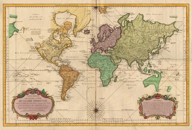
"Carte Reduite des Parties Connues du Globe Terrestre, Dressee au Depost des Cartes Plans et Journaus de la Marine pour le Service des Vaisseaux du Roy…",

Subject: World

Period: 1755 (dated)

Publication:

Color: Hand Color

Size:
32 x 21 inches
81.3 x 53.3 cm
Download High Resolution Image
(or just click on image to launch the Zoom viewer)

A very large world chart on Mercator's projection. North America is shown with a partial "Mer de l'Ouest", and the Russian discoveries of 1728 and 1741in the Northwest. There is an odd river and lake network connecting Hudson Bay with Lake Superior. Australia is shown as "Nouvelle Hollande" with "Terre de Diemen" linked to the mainland. New Guinea and "Terre du S. Esprit (New Herbrides) also linked to the mainland. A partial coast of New Zealand and the Soloman Islands appear in the Pacific. Large, decorative title and distance scale cartouches and a fine compass rose with rhumb lines. Printer's crease at bottom and a short fold split in top margin, well away from map.

References:

Condition: A

Estimate: $1,400 - $1,600

Sold for: $1,900

Closed on 6/14/2000

Archived