Subject: India and Pakistan
Period: 1690 (circa)
Publication:
Color: Hand Color
Size:
19.2 x 14.5 inches
48.8 x 36.8 cm
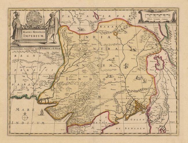
Lovely copper engraved map of the region of modern day Pakistan, northern India and Bangladesh. The map was first issued by Jan Jansson and reissued by Valk and Schenk who purchased the original plates. The Indus and Ganges rivers are the most prominent features of the map, along with the large imaginary lake located in northern Burma. This lake's origins are linked to Hindu-Buddhist mythology and appeared on maps, in some form, up until the early 20th century. Wild beasts, including lions, tigers and elephants, roam the interior, while a ship sails in the Indian Ocean. The map is further embellished with a large title cartouche flanked by two finely dressed gentlemen, and a strapwork distance scale. Very clean with good original color.
References:
Condition: A+