Catalog Archive
Auction 91, Lot 131

"General Karte von Nord America samt den West Indischen Inseln Verasst von Herrn Pownall",

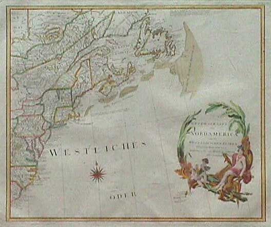
Subject: Eastern United States

Period: 1788 (dated)

Publication:

Color: Hand Color

Size:
22.7 x 20 inches
57.7 x 50.8 cm
Download High Resolution Image
(or just click on image to launch the Zoom viewer)

Very uncommon Austrian map covering from Labrador to Port Royal in South Carolina. The map is based on the surveys of Major Samuel Holland and Governor Thomas Pownall. Great detail throughout with numerous Indian nations and notations of various explorations. Large decorative title cartouche with a Native American woman and her children. Later outline color with a fully colored cartouche and compass rose. Very wide margins.

References:

Condition: A

Estimate: $750 - $850

Sold for: $550

Closed on 6/14/2000

Archived