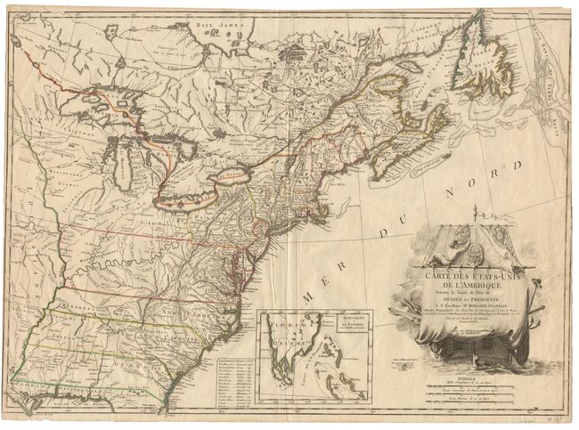
Subject: Eastern United States
Period: 1784 (circa)
Publication:
Color: Hand Color
Size:
30 x 21.325 inches
76.2 x 54.2 cm
The first French map to identify the newly formed United States, and one of the most beautiful maps of the period. The states of North and South Carolina and Georgia extend to the Mississippi River. Florida is divided into West and East Florida, with an inset depicting the tip and the Bahamas. The map is dedicated to Benjamin Franklin, ambassador to France. The stunning cartouche contains the title and dedication on the unfurled sail of a ship sailing in the Atlantic. This is an issue by Charles Francois Delamarche who purchased the plates and stock of Lattre and added his own name to the map. Both states of the map are uncommon. Close margins, as issued, with no margin at lower left. Fine impression and original color. Ref: Ristow, p. 63. $3,250 RESERVE
References:
Condition: A