Catalog Archive
Auction 91, Lot 111
"A Map of New France Containing Canada, Louisiana &c. in Nth. America According to the Patent granted by the King of France to Monsieur Crozat, dated the 14th of Sep. 1712 N.S. and registered in the Parliament of Paris the 24th of the same Month"
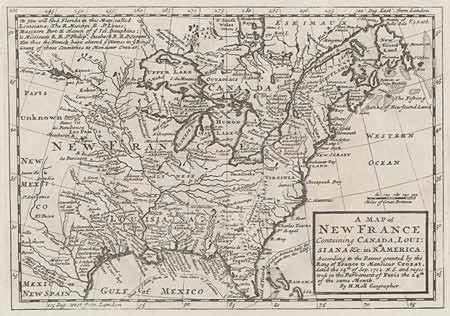
Subject: Colonial Canada and United States
Period: 1745 (published)
Publication: A Collection of Voyages and Travels…
Color: Black & White
Size:
10.2 x 7 inches
25.9 x 17.8 cm
Download High Resolution Image
(or just click on image to launch the Zoom viewer)
(or just click on image to launch the Zoom viewer)