Catalog Archive
Auction 88, Lot 99

"Map of Oregon and Upper California from the surveys of J.C. Fremont and other Authorities", Fremont/Preuss

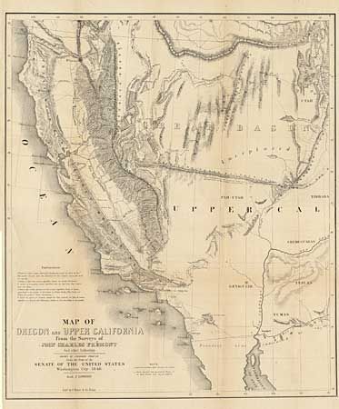
Subject: Western United States

Period: 1848 (dated)

Publication: House Ex Doc. #17, 31st Congress

Color: Black & White

Size:
19.5 x 16.5 inches
49.5 x 41.9 cm
Download High Resolution Image
(or just click on image to launch the Zoom viewer)

This is the smaller version of Fremont's highly respected map of the west, published by Congress, in 1850, to meet the demand for information concerning the Gold Rush. The map covers a smaller area than his larger map of the same title, eliminating Oregon and covering only the western parts of present day Arizona and Utah. "El Dorado or Gold Regions" are shown on the south fork of the American River and the upper course of the Feather River. Contains Fremont's famous topographical error, showing an east-west mountain range across the unexplored area of the Great Basin. Ref: Wheat (TMW) #613, Wagner Camp #150, Wheat (Gold) #58. Folds as issued and excellent condition.

References:

Condition: A+

Estimate: $300 - $375

Sold for: $400

Closed on 10/2/1999

Archived