Catalog Archive
Auction 88, Lot 96

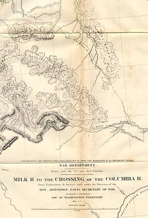
"Milk R. to the Crossing of the Columbia R.", U.S. War Dept.

Subject: Northwestern United States

Period: 1853-5 (dated)

Publication: Pacific Railroad Surveys

Color: Black & White

Size:
60.5 x 23.2 inches
153.7 x 58.9 cm
Download High Resolution Image
(or just click on image to launch the Zoom viewer)

A large folding map published in 1860 in the reports of the Pacific Railroad Surveys as they surveyed for a northern route (47th and 49th Parallels) on an expedition led by Isaac Stevens, Governor of Washington Territory. Most of map covers Montana, with extraordinary detail and excellent relief, naming rivers, numerous routes with dates, and interesting topographical commentary. Folding as issued. Very good condition with only one minor separation at a fold intersection.

References:

Condition: A

Estimate: $250 - $275

Sold for: $100

Closed on 10/2/1999

Archived