Catalog Archive
Auction 88, Lot 14

"Mappe-Monde Dresse sur les Observations de Mrs. De l'Academie Royale des Sciences…",
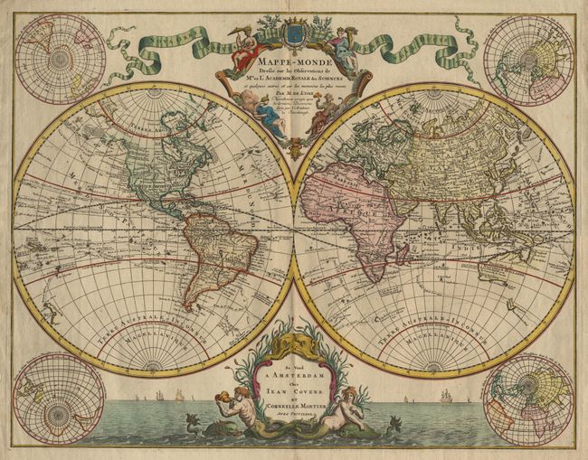
Subject: World

Period: 1730 (circa)

Publication:

Color: Hand Color

Size:
25.5 x 19.5 inches
64.8 x 49.5 cm
Download High Resolution Image
(or just click on image to launch the Zoom viewer)

Exquisite large world map after Delisle. The twin hemispheres include the routes and dates of major explorers, from Magellan to Bering. Only the northern and western coastlines of Australia are shown, along with part of "Terre de Diemens and Nle Zelande" On the northwest coast of North America, Alaska is beginning to take shape from the discoveries of Bering. Surrounding the map are four polar projections. The elaborate upper title cartouche includes four female personifications of the continents. The lower cartouche floats in the sea with a merman & mermaid and sea monsters. Tiny fold separation in top margin, else fine.

References:

Condition: A

Estimate: $2,700 - $3,000

Sold for: $1,900

Closed on 10/2/1999

Archived