Catalog Archive
Auction 88, Lot 128

"Map of Indian Territory", Boudinot, E. C.
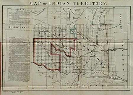
Subject: Oklahoma

Period: 1879 (dated)

Publication: Sen. Doc. #20, 46th Congress, 1st Ses.

Color: Printed Color

Size:
22 x 15 inches
55.9 x 38.1 cm
Download High Resolution Image
(or just click on image to launch the Zoom viewer)

This fascinating map was produced in response to requests for information concerning the new "Public Lands" in a letter from Senator A. Albert. Col. Boudinot's response traces the titles of various Indian lands within the territory in an attempt to "set the records straight". The locations of a number of Army forts are noted. Inset beside the map are copies of the letter from Sen. Albert and the response from Col. Boudinot providing an interesting view of the development of the territory. A significant and important map for any Oklahoma collection.

References:

Condition: A+

Estimate: $150 - $200

Sold for: $220

Closed on 10/2/1999

Archived