Subject: Western Hemisphere - America
Period: 1856 (published)
Publication: The Physical Atlas of Natural Phenomena
Color: Printed Color
Size:
23.1 x 18.8 inches
58.7 x 47.8 cm
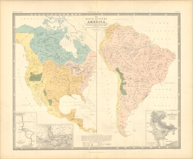
This interesting thematic map presents the river systems in both North and South America and is color-coded to show "the different Oceans &c. to which the Rivers of America contribute their Waters." Areas shaded in green are basins that do not empty. Each colored region is named and its size is noted in square miles. There are three inset maps at bottom including Niagara Falls, the Mississippi Delta, and the Orinoco River. Surrounded by a keyboard-style border. Accompanied by a related page of text from the atlas.
Keith Johnston worked in conjunction with German Heinrich Berghaus to produce the Physical Atlas, the first truly comprehensive thematic atlas. The maps from this atlas made a huge impact on cartography in general and specifically on the graphic portrayal of geographical data.
References:
Condition: A
A crisp impression with minor toning along the sheet edges.