Subject: Western Hemisphere - America
Period: 1780 (circa)
Publication: Geographie Moderne
Color: Hand Color
Size:
21.8 x 12.5 inches
55.4 x 31.8 cm
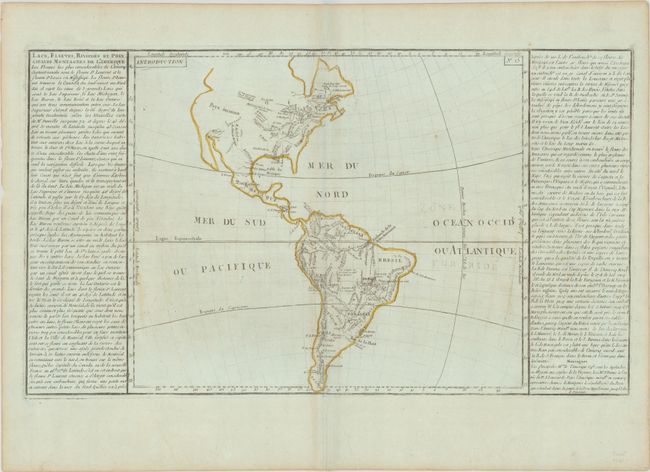
An interesting map of the Americas with a focus on the lakes, rivers and mountains. Only a few cities and forts are identified, including Quebec, New Orleans, Natchitoches (on the Red River), and Fort Francois (on the Ohio River). Designed for a French school atlas, the map presents a rudimentary image of North America with no mountains in the west except a few shown in what is present-day New Mexico and Colorado. The Andean Volcanic Belt is well represented. French text at sides provides an explanation to the map.
References: Phillips (Atlases) #3519-15.
Condition: B+
Printed on bluish paper with contemporary outline color, light soiling, a couple of small rust spots, and light toning along the edges of the sheet.