Subject: Western Hemisphere - America
Period: 1746 (dated)
Publication:
Color: Hand Color
Size:
21.1 x 18.4 inches
53.6 x 46.7 cm
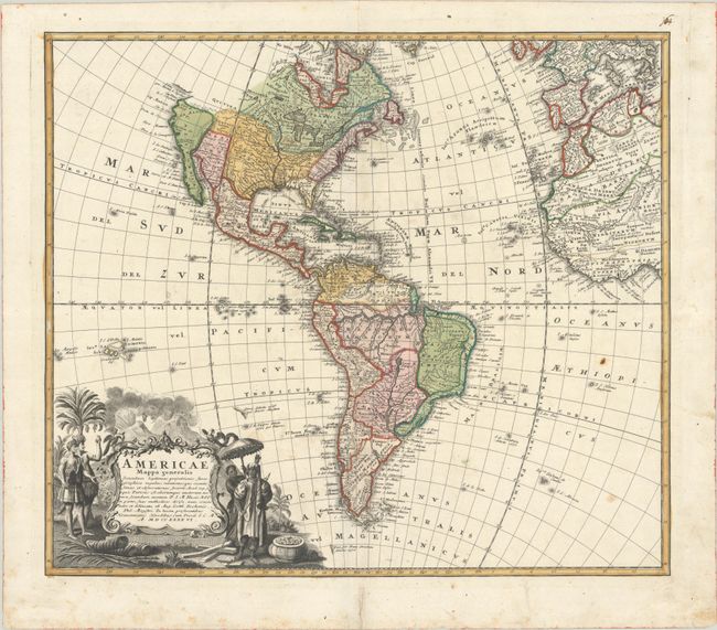
This is a handsome, decorative eighteenth century map of the Americas with considerable detail throughout. It extends to the western part of Africa and southwest Europe. There is only an amorphous coastline shown above the peninsular California, with the Pacific Northwest left blank. The very large title cartouche includes two erupting volcanoes, Native Americans, palm trees, sugar cane, parrots, and a pot of gold. Johann Matthias Haas was a professor of mathematics at Wittenberg, and he worked with the Homann Heirs updating their map stock.
References:
Condition: B+
A particularly sharp impression on a watermarked sheet with original color, light soiling and a rust spot in the south Atlantic Ocean. There is a short centerfold separation in the top and a tear in the bottom margin that has been archivally repaired.