Subject: Western Hemisphere - America
Period: 1682 (published)
Publication: Le Monde ou la Geographie Universelle
Color: Hand Color
Size:
5 x 4 inches
12.7 x 10.2 cm
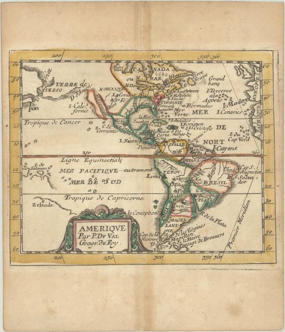
Charming miniature map of the Americas. California is shown as an island and the D. d'Anien separates California from a huge Terre de Iesso, with a D. de Vriez separating Iesso from an unnamed Asia. The Spanish colony of St. Fe is identified, Quebec is shown as the capital of the French possessions and St. Augustine is shown in Florida. N. Suede is incorrectly shown, as the Dutch took possession of that colony in 1655. In the Pacific, the recently discovered coastline of New Zealand is depicted as a remnant of the old southern continent. This is the third state, with a modified title cartouche. Pierre Duval was Nicolas Sanson's nephew and pupil. He published a wide range of atlases and individual maps including a fine miniature world geography with many of the maps based on Sanson.
References: Burden #350; McLaughlin #26; King (3rd ed) #1660; Pastoureau, Duval XI Fa.
Condition: B+
A nice impression with original outline color in the map and later color in the cartouche, on a watermarked sheet with light toning along the centerfold and edges of the sheet. There are a few spots of foxing in the blank margins. Side margins are a bit narrow, as issued.