Subject: Atlases
Period: 1898 (published)
Publication:
Color: Printed Color
Size:
16.8 x 21.3 inches
42.7 x 54.1 cm
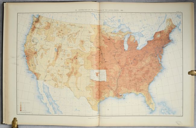
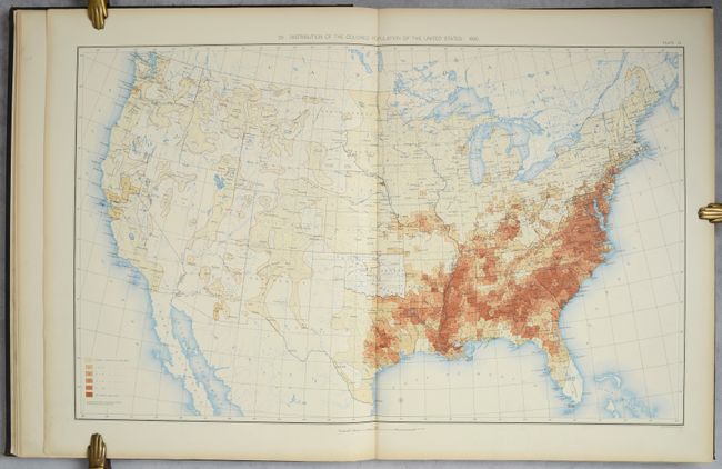
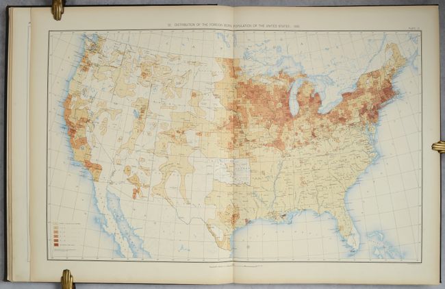
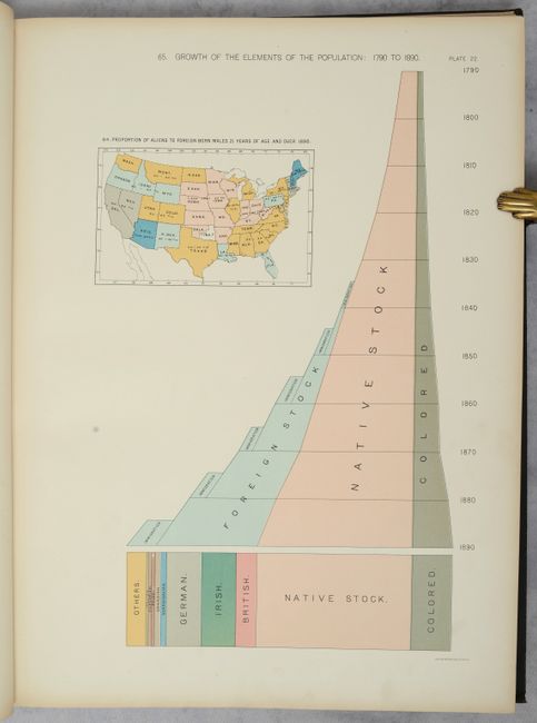
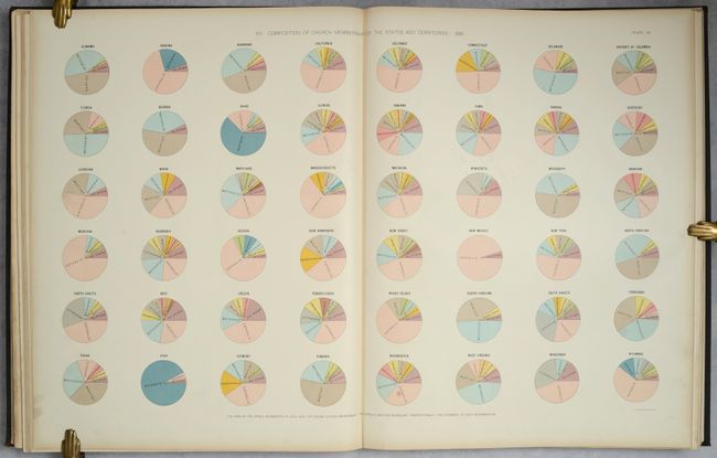
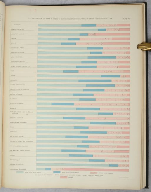
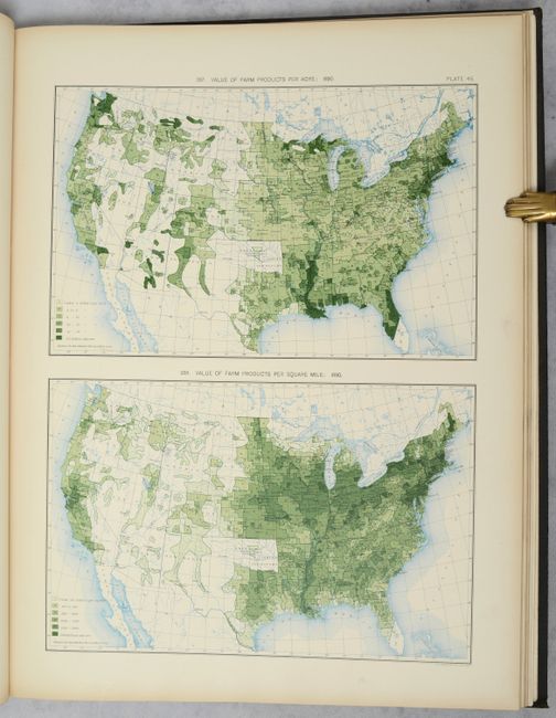
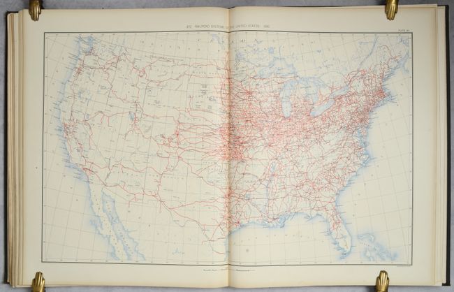
This large and important atlas is complete with 63 plates consisting of numerous thematic maps, graphs, and tables that describe population, migration, agriculture, industry, wealth, and much more. A few maps of particular interest are population maps entitled Distribution of the Colored Population of the United States which shows a strong minority concentration in the southern states, and Proportion of the Foreign-Born to the Aggregate Population which shows high representation in the northern and western states. Also noteworthy are the maps that show the population density for each decennial census from 1790 to 1880. Schwartz & Ehrenberg commended an earlier edition of this atlas saying it was a "pioneering work [and] was the first atlas of analytical maps that showed the patterns of associations and it greatly influenced the development of thematic mapping in the United States." Compiled by Henry Gannett. Large folio, bound in brown cloth with gilt title on the front cover.
References: cf. Schwartz & Ehrenberg p. 303.
Condition: B+
Contents are remarkably clean and bright with an occasional bit of soiling along the right edge of the sheets. A small section of text containing 6 plates has detached from the binding, otherwise this would be an "A" example. Rebacked with some staining, wear and a small gouge all on the rear cover.