Subject: Atlases
Period: 1860 (circa)
Publication:
Color: Hand Color
Size:
13.3 x 19.2 inches
33.8 x 48.8 cm
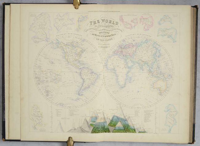
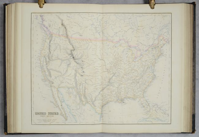
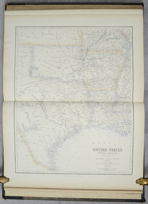
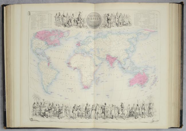
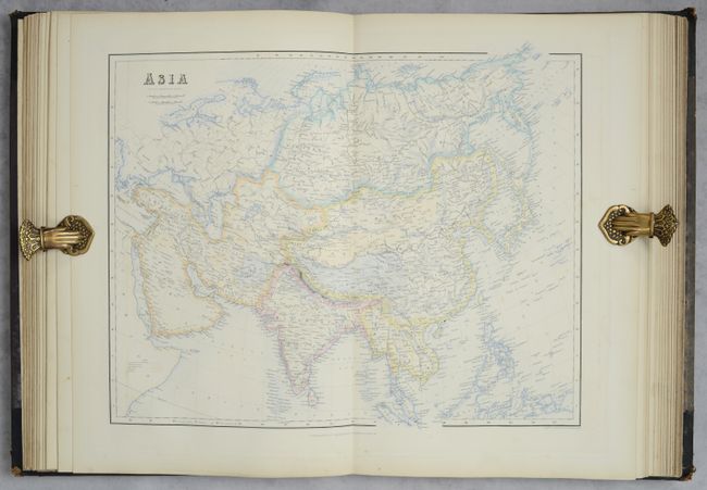
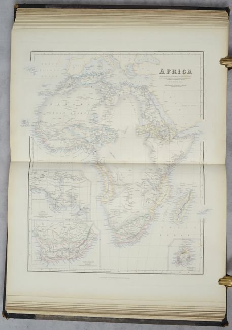
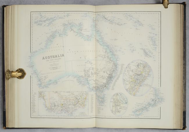
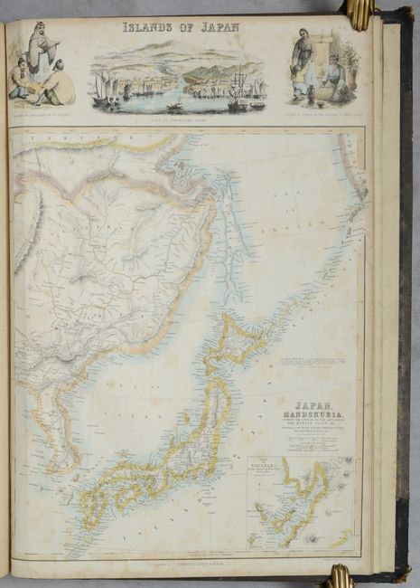
This composite atlas contains 36 (of 48) maps from Swanston & Fullarton's Companion Atlas to the Gazetteer of the World. 35 of the 36 maps are double-page (Japan is single-page), all are on sturdy paper with blank versos, and feature contemporary outline color. Geographically, there are maps of the world (3), Europe (18), Asia (4), Africa (1), Australia (2), and the Americas (8). Of particular interest is the double-hemisphere world map that features an elaborate comparative view of principal mountains at bottom. The map focuses on rivers and includes a broken outline of Antarctica. In addition to the comparative mountain view, the basins of the most important rivers flank the map, including the Amazon, La Plata, Rhine, Danube, Volga, Indus, Ganges, Yenesei, Mississippi, and Missouri rivers. Also of interest are the 5 maps of the United States, including the 4 regional maps dividing the country into quadrants as well as the double-page map of the entire nation. This latter map features the largest configurations of Oregon, Utah and New Mexico territories along with an oversized Nebraska Territory spanning from the Missouri River to the Rocky Mountains. The Texas panhandle spans north to the Arkansas River, crossing well into present-day Colorado (a surprising feature given the publication date). No title page. Hardbound in half leather over cloth boards. The full list of maps are below.
1. The World
2. Scotland
3. South America
4. France
5. Prussia
6. North America
7. Europe
8. States of the Germanic Confederation
9. West Indies
10, Austrian Empire
11. Denmark
12. British Empire Throughout the World
13. Sweden and Norway
14. Asia
15. Spain & Portugal
16. England & Wales
17. Holland & Belgium
18. Central Europe
19. Greece
20. United States
21. Australia and New Zealand
22. Ireland
23. Italy
24. The World on Mercator's Projection
25. United States - The North Eastern States
26. United States - The North Central Section
27. United States - The South Eastern States
28. Africa
29. China
30. Switzerland
31. Russian Empire
32. Oceania, or Islands in the Pacific Ocean
33. United States - The South Central Section
34. Railway Map of the British Isles
35. Japan, Mandshuria
36. Indian Archipelago
References:
Condition: A
Condition code is for the maps, which have contemporary outline color on sturdy sheets. They are mostly near fine with occasional faint foxing in the image and minor soiling mostly in the margins. The single-page map of Japan has more prominent foxing (B). Covers have rubbed edges and some sunning to the cloth on the front cover.