Subject: Atlases
Period: 1782 (published)
Publication:
Color: Hand Color
Size:
3.5 x 5.1 inches
8.9 x 13 cm
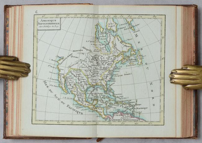
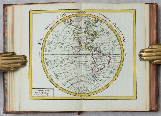
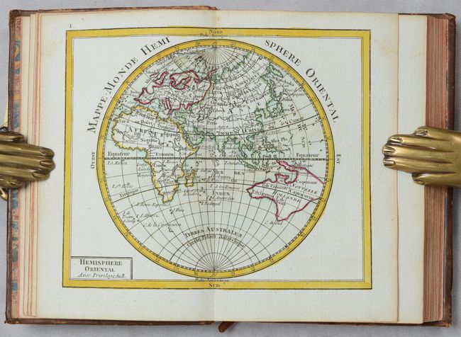
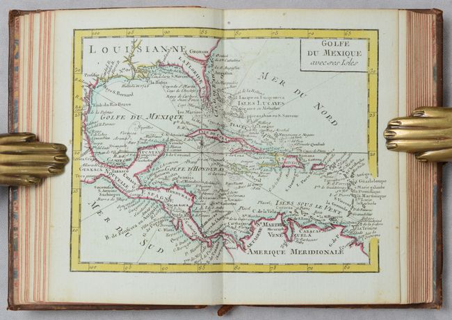
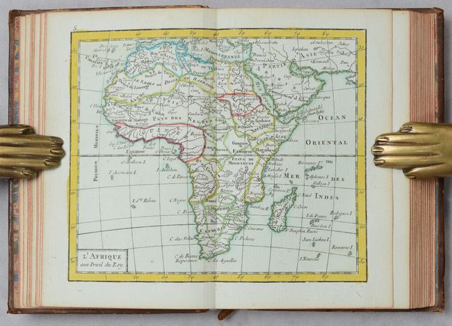
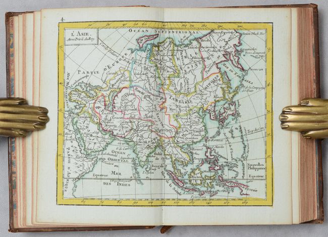
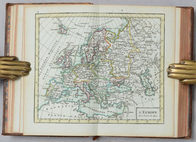
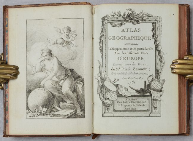
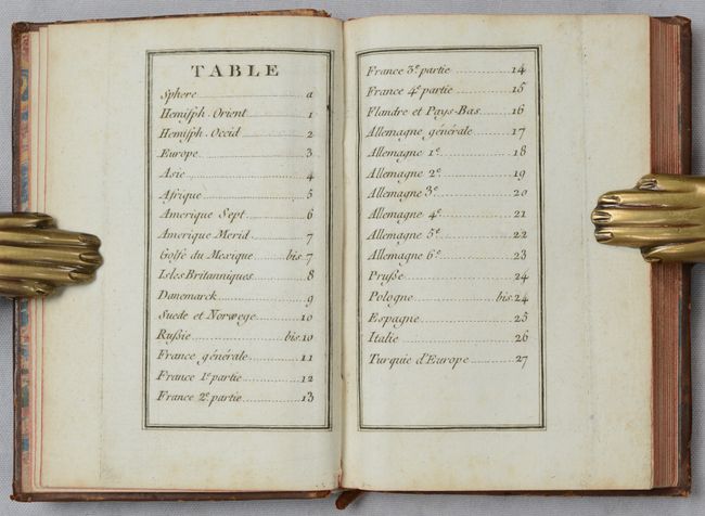
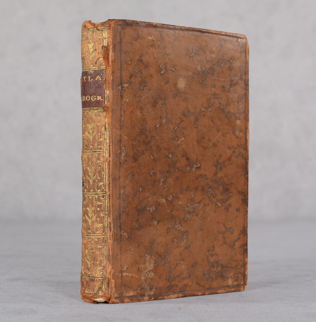
This handsome miniature atlas is complete with 30 maps. It includes maps of the Eastern and Western hemispheres, the continents (Europe, Asia, Africa, and North and South America), and the regions of Europe. Also included in this edition are four new maps that did not appear in the first edition of 1762: Golfe du Mexico avec ses Isle, Russie en Europe, La Pologne, and Turquie d'Europe. A new Ptolemaic diagram has also been added. Cartographically, the map of the Eastern Hemisphere shows a large Australian landmass with New Guinea and Tasmania still connected. On the North America map, the northwestern coast is undefined and virtually blank, and the British colonies are simply labeled Caroline. There is an attractive frontispiece depicting the allegorical figure of Geography measuring a globe with a putto's assistance. Engraved by Lattre. 12mo., hardbound in contemporary leather with gilt decorations and title on spine.
References: cf. Shirley (BL Atlases) T.RIZ-1b.
Condition: A
Maps are in excellent condition with original color and occasional minor offsetting or foxing that is mostly confined to the margins. Covers have light shelf wear, slightly bumped corners, and minor chipping along spine.