Subject: Atlases
Period: 1720 (circa)
Publication:
Color: Hand Color
Size:
10 x 14.8 inches
25.4 x 37.6 cm
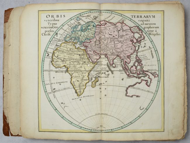
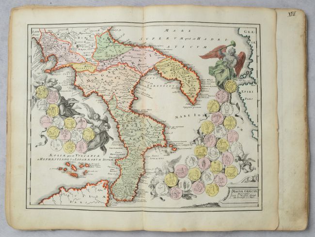
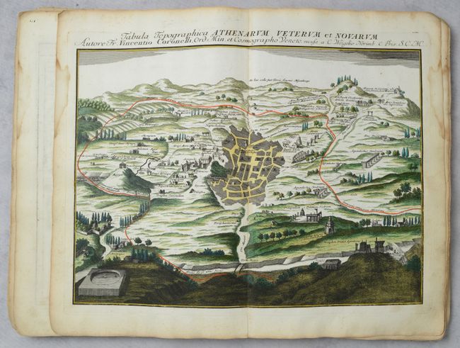
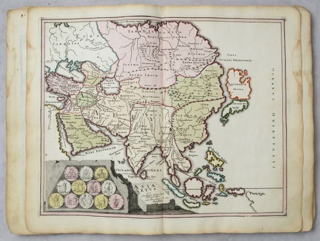
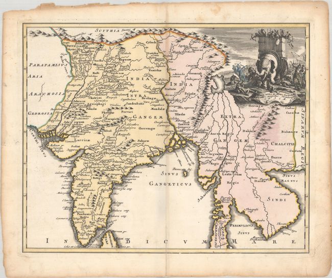
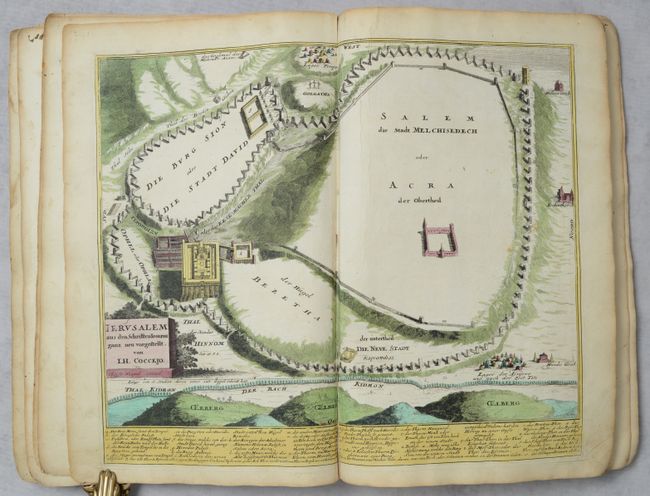
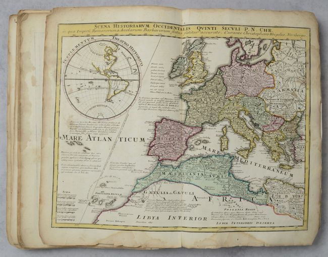
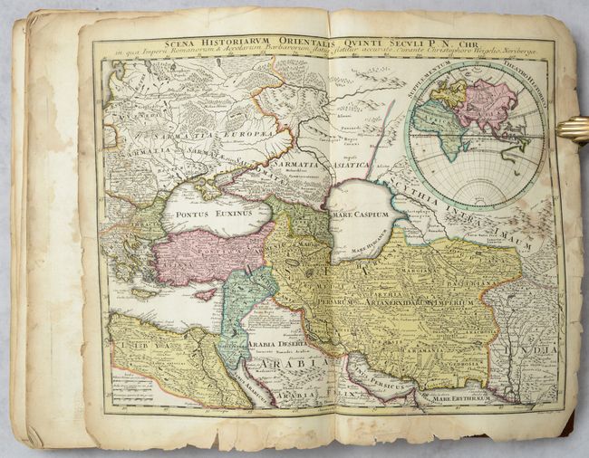
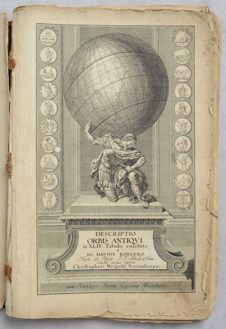
Christoph Weigel (1654-1725) was a goldsmith, engraver, illustrator, and publisher in Nuremberg, Germany, where he produced many maps and atlases of both the ancient and the modern world. Of particular interest is the fact that all his maps were hand-colored immediately after they were printed in his publishing house. The majority of early map publishers issued their maps in black and white with later coloring added by outside artists and colorists. Weigel's Descriptio Orbis Antiqui is an atlas of classical maps, most of which incorporate medallions or coins relating to the region depicted in the map. The atlas is near complete, featuring 43 of the 44 maps listed in the table of contents, with only Map 38, Africa Vetus, missing. The maps are preceded by a mezzotint frontispiece portrait of historian Johann David Kohler and a beautifully engraved title page featuring a Caesar-like figure hoisting a globe between two columns of medallions. The list of maps are as follows:
1. Orbis Terrarum Veteribus Cogniti...
2. Europa Vetus
3. Hispania Vetus
4. Gallia Vetus ex Julii Caesaris Commentariis
5. Gallia Transalpina in suas Quatuor Provincias
6. Gallia Belgica et Germania Utraque
7. Insulae Britannicae Antiquae
8. Britanniae Romanae Tabula
9. Germaniae Antiquae
10. Germania Ptolemaei
11. Vindelicia Rhaetia
12. Italia Antiqua
13. Gallia Cisalpina et Italia Propria
14. Italia Media
15. Omnia Romanae
16. Magnae Graeciae
17. Ora Baiana
18. Sicilia Antiqua
19. Insularum Corsicae, Sardiniae Melitae
20. Regiones Danubianae
21. Thracia Antiqua
22. Graeciae Septentrionalis Pars
23. Graeciae Pars Meridionalis
24. Tabula Topographica Athenarum
25. Asia Vetus
26. Asia Peninsula
27. Armenia Utraque
28. Asia intra Maeotium
29. Syriia Propria
30. Palaestinae
31. Facies Palastinae
32. Castra Metatio
33. Jerusalem
34. Arabiae Veteris
35. Mesopotamiae
36. Persia
37. India Intra et Extra Gangem
38. Mauretania
39. Africa Propria
40. Aegyptus Antiqua
41. Aegyptus Inferior
42. Scene Historiarum Occidentalis
43. Scene Historiarum Orientalis
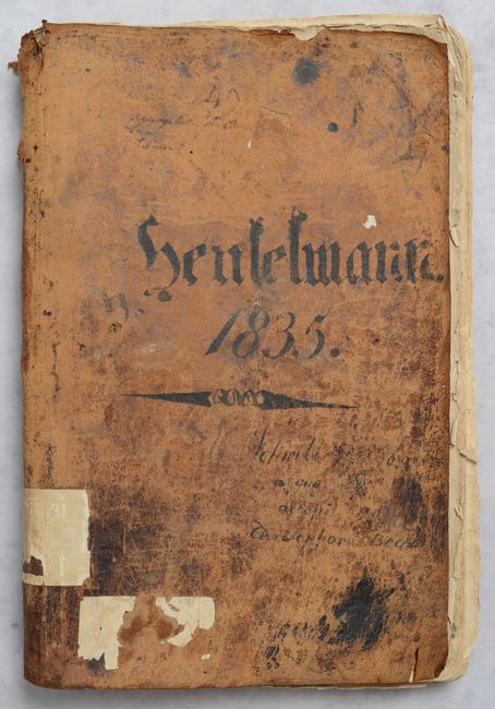
Folio. Disbound. Original covers have been replaced with soft leather covers (no boards), dated 1835 with other notations on cover in manuscript ink, wrapping around a loose, but mostly intact text block.
References: Shirley (BL Atlases) T.WEIG-2a.
Condition:
All of the maps are in bold contemporary color with occasional light soiling. Overall, 7 maps are in A condition, 31 maps are in B+ condition, and 5 maps are in B condition. A small puncture hole in the front cover goes through the text block to the 14th map, with most of the holes closed on verso with old paper and only small loss of image on the maps. There are some centerfold separations and edge tears, most of which have been repaired on verso with archival materials. The last seven maps in the book have marginal dampstaining, and there is moderate staining in the engravings of the Sicily map and the final two <i>Scena Historiarum</i> maps. The mezzotint is in C+ condition with the infilled puncture hole, some creasing, short edge tears, and a chip at top right. Title page is in B condition with a small amount of image loss from the puncture hole and light staining and soiling, with a faded stamp from previous owner. Text block is loose from binding, but mostly intact; the frontispiece and three maps (Gallia Vetus, Mesopotamia, and India) are completely loose and some more are shaken. Disbound, with replacement covers present. Leather covers are heavily scuffed with chipping along edges and spine, and remnants of label at bottom.