Catalog Archive
Auction 209, Lot 66
NO RESERVE
"Map of the Principal Rivers Throughout the World", Carey & Lea
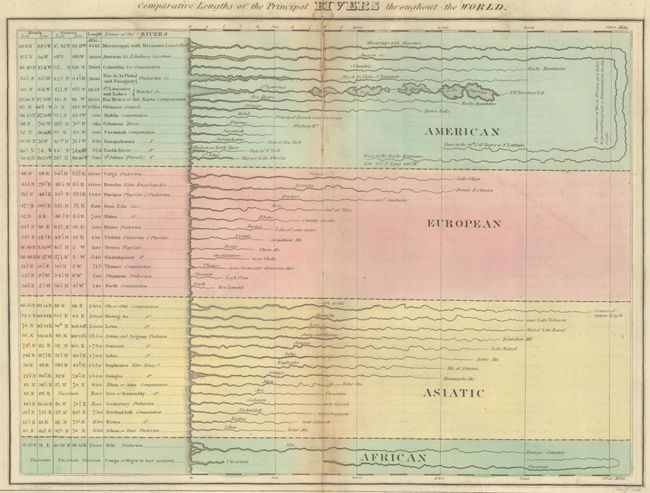
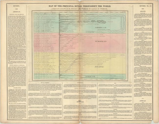
Subject: Cartographic Miscellany, Rivers
Period: 1827 (published)
Publication: A Complete Historical, Chronological, and Geographical American Atlas
Color: Hand Color
Size:
13.6 x 10 inches
34.5 x 25.4 cm
Download High Resolution Image
(or just click on image to launch the Zoom viewer)
(or just click on image to launch the Zoom viewer)