Catalog Archive
Auction 209, Lot 641
Scarce Dated Events War Map Published Immediately After Pearl Harbor
"Dated Events War Map of the Pacific and Far East [Second Edition]", Turner, Stanley
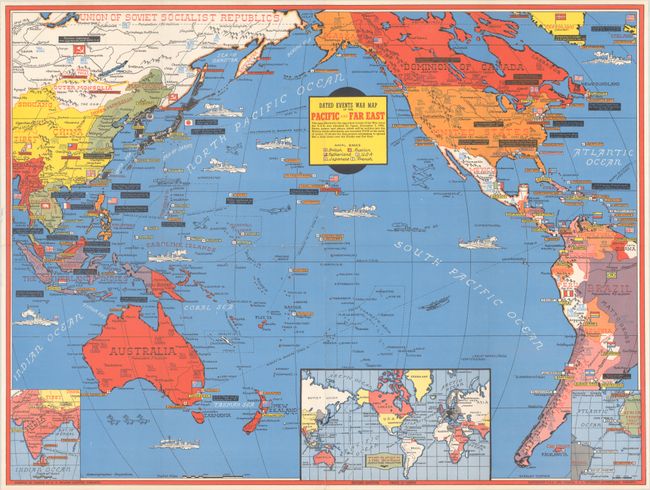
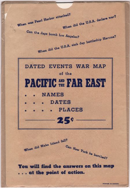
Subject: Pacific Ocean, World War II
Period: 1942 (dated)
Publication:
Color: Printed Color
Size:
26.3 x 19.8 inches
66.8 x 50.3 cm
Download High Resolution Image
(or just click on image to launch the Zoom viewer)
(or just click on image to launch the Zoom viewer)