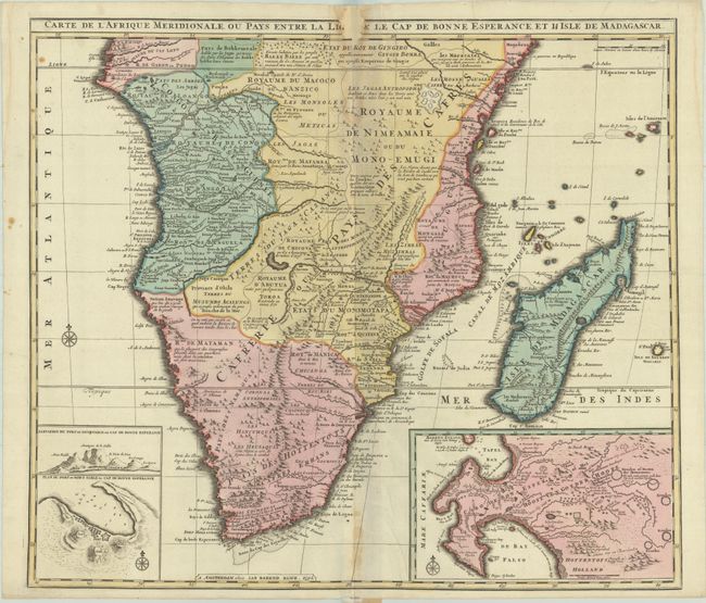
Subject: Southern Africa & Madagascar
Period: 1792 (dated)
Publication:
Color: Hand Color
Size:
22.9 x 20.1 inches
58.2 x 51.1 cm
A fine folio map of Africa south of the Equator including all of Madagascar, with two interesting insets of the Cape of Good Hope. At left is a plan of Table Bay with an elevation of Table Mountain, and at right is a large plan of the Cape Colony with extensive detail and fairly accurate topographical information including the names of early landowners. The main part of the map includes the various native kingdoms of the interior and what was known then of the coastline, much of which is fictitious. The cartography is based on Visscher's map of 1710.
References: Norwich #180.
Condition: B
A dark impression with full original color on a bright sheet with a pair of elephant watermarks. There are several dampstains along the centerfold, resulting in a chip at top that has been professionally repaired with loss of two letters within the title and a bit of the border. There are a few minor creases adjacent to the centerfold.