Subject: Egypt & Red Sea
Period: 1790 (circa)
Publication: Voyage aux Sources du Nil, en Nubie et en Abyssynie
Color: Hand Color
Size:
19.4 x 24 inches
49.3 x 61 cm
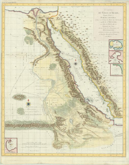
This fascinating and intricately detailed map of the Red Sea and Nile valley was published in the French translation of James Bruce's travels. In 1768, Bruce traveled down the Red Sea as far as the straits of Bab-el-Mandeb and then struck inland for Gondar, the capital of Ethiopia. He rediscovered the source of the Blue Nile, which he followed to its confluence with the White Nile. Four small insets detail the harbors of Rabac, Ibraim, Sebt, and Masuah. Some historical researchers believe that much of the motivation behind Bruce's epic travels in Ethiopia centered around his desire to recover sacred objects connected with Solomon's Temple and in verifying legends associating the medieval Knights Templar with old Christian churches in Ethiopia.
Scottish traveler James Bruce was one of the earliest westerners to search for the source of the Nile. His Travels to Discover the Source of the Nile (1790) greatly enhanced Europe's knowledge of the geography and ethnography of this portion of Africa. Bruce believed the Blue Nile, although smaller than the White Nile, was the Nile of the ancients and focused his explorations on this river. In November of 1770 he reached the source of the Blue Nile and claimed to have discovered its source.
References:
Condition: A
Issued folding, now flat, on watermarked paper. There are a few minor spots and archival repairs on verso to a few fold separations and a tiny hole in an unengraved area of the map.