Subject: Southeast Asia, World War II
Period: 1942 (published)
Publication:
Color: Printed Color
Size:
22.8 x 16.5 inches
57.9 x 41.9 cm
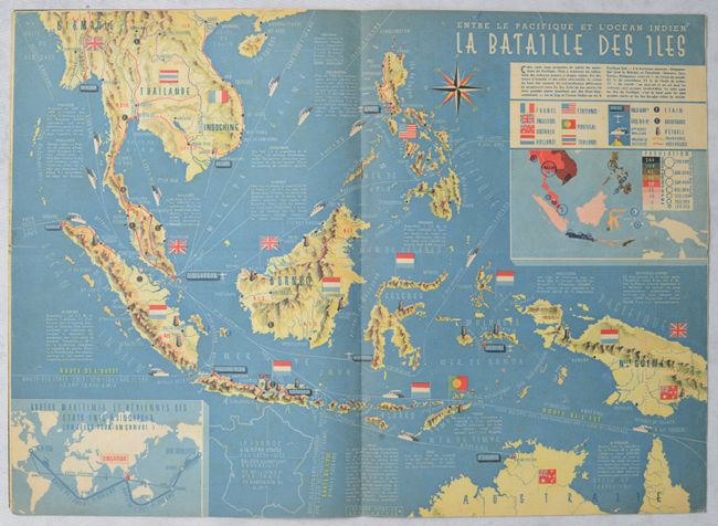
This fascinating World War II-era map uses pictorial elements to depict Southeast Asia during wartime. The map shows mainland Southeast Asia south of Hanoi as well as the Philippines, Indonesia, and the northern part of Australia. Flags identify the colonial powers in the region, and the legend locates naval and air bases, maritime routes, active volcanoes, places that produce tin, rubber, and oil, borders, and railways. Below the legend is an inset population map. Another inset map shows air and maritime routes from the United States to Southeast Asia. An outline map of France appears in the ocean to compare with the various islands. The map was designed by graphic artist Jacques Mercier for the January 25, 1942 edition of 7 Jours. The entire issue of the magazine is included here, with an ice skater on the cover.
References:
Condition: B+
A colorful example with a staple along the centerfold as issued. There is light foxing, archival repairs to 1" (left) and 0.5" (top) edge tears, and a few tiny tack holes in the upper corners. Magazine covers are lightly dampstained at right, with no visible impact on map image.