Subject: Southeast Asia
Period: 1747 (published)
Publication: A Complete System of Geography...
Color: Black & White
Size:
16.7 x 13.6 inches
42.4 x 34.5 cm
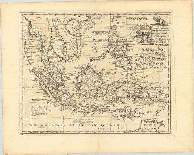
This excellent map of the region depicts Mainland Southeast Asia, Indonesia, the Philippines, and part of northern Australia. The Caroline Islands are located too close to the Philippines, a common error in the period. There are notes referring to the gold and silver of Sumatra, the unknown nature of Java and Borneo, the production of spices near Banda, and more. The fragment of New Holland (Australia) in the southeast corner of the map shows Arnhems Landt, with the name Van Diemens Landt curiously appearing just off the coast. The decorative title cartouche incorporates a vignette featuring figures under flat shade umbrellas.
References: McCorkle (18th C. Geography Books) #17-14 (Vol II); Shirley (BL Atlases) T.BOW-2a #44.
Condition: B+
A sharp impression on a sheet with the fleur-de-lis coat of arms watermark of Lubbert van Gerrevink. There is light offsetting and a small rust spot by the compass rose. A short centerfold separation is confined to the bottom blank margin.