Subject: Southeast Asia
Period: 1638 (published)
Publication: Atlas Novus
Color: Hand Color
Size:
19.9 x 15.4 inches
50.5 x 39.1 cm
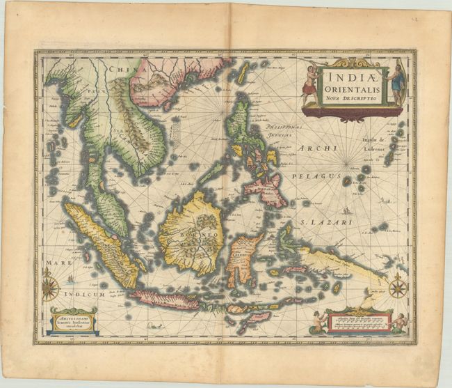
A decorative chart of the region including Indochina, the Philippines, and the East Indies. The map is significant for being one of the earliest to include the new discoveries made by the Dutch Duyfken exploration, as evidenced by Duyfkens Eylant depicted just below New Guinea. The Duyfken was a small ship that made landfall in 1606 on the shores of Australia's Cape York Peninsula, and is credited with the first authenticated European landing on Australian soil. The map is embellished with rhumb lines, sailing ships, sea monsters, compass roses, and three cartouches. The cartouches feature indigenous people, mermaids, and a sea monster. Latin text on verso.
References: Van der Krogt (Vol. I) #8500:1B.1.
Condition: B+
A nice impression on watermarked paper with toning along the centerfold, a few faint spots, and some minor printer's ink residue. There is some light toning and scattered foxing in the blank margins.